
Products Categories
-
Marine and Offshore
- Marine Deck Machinery
- Marine Mooring Equipment
- Marine Anchoring Equipment
- Pushing & Towing Equipment
- Marine Outfitting Equipment
- Marine Life-Saving Equipment
- Marine Power and Propulsion
- Marine Auxiliary Equipment
- Marine HVAC System
- Marine Pumps
- Marine Valves
- Marine Electrical Equipment
- Marine Decorations
- Marine Hardware
- Offshore & Engineering Products
- Fishing and Diving
- Yacht Accessories
- Industry Products
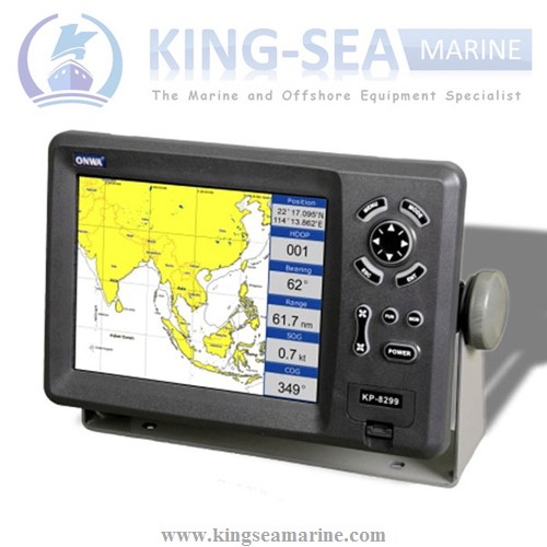
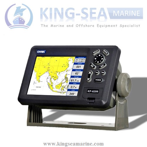
8 Inch SD Card Marine GPS Chart Plotter
Features: 1. High Resolution 8 inches Color TFT Display, 800
600 pixels 2. 8 Color or 8 Level Amber Presentation 3. 50/200 KHz Transceivers, Output Power: BMMEEGPS-001 600 Watt 4. Blue, Light Blue, or Black,Background Color 5. 8 Range Scales, from 0-15 to,0-1000 Feet 6. Range Offset to 1000 Feet,Maximum Offset Range of 2000 Feet 7. Automatic Ra…
Share this:
|
PLOTTER CHARACTERISTICS |
|
|
1. Waypoints/icons |
15,000 waypoints with name, symbol, 10 proximity waypoint |
|
2. Routes |
waypoint up to 200 points each, plus MOB and Track Navigation or Goto |
|
3. Tracks |
30,000 point automatic track log; 15 saved track (up to 2000 track points |
|
4. Alarms |
XTE, Anchor drag, arrival, speed, voltage, proximity waypoint and time, |
|
5. Pallete |
Normal |
|
6. Tides |
Tide data |
|
7. Projection |
Mercator projection |
|
8. Position format |
Lat/Lon |
|
9. Basemap |
Built-in Onwa K-Chart |
|
10. External Map |
SD Cards slot for C-Map MAX |
|
11. User data storage |
Internal backup of user settings, or external SD-card |
|
12. Plot Interval |
1s to 99h or 0.01 nm to 9.99nm |
|
13. Plotting scales |
0.01nm to 1,000nm |
|
14. Nav Datat |
Inputs: |
|
15. Perspective View |
On/off |
|
POWER SUPPLY |
10.5 to 35VDC, current drain <500mA at 12V |
|
PHYSICAL |
|
|
1. Size |
290mm(H)X195.5mm(W)X99.5mm(D) |
|
2. Weight |
2.43kg |
|
3. Display |
8.0-inches ColorTFT day-view LCD 800 X 600 pixels |
|
4. Waterproofing |
Display unit: IPX5 |
|
5. Temperature range |
Display unit: -15℃ to +55℃ |
|
GPS RECEIVER CHARACTERISTICS |
|
|
1. Receiver |
50 parallel channel GPS receiver continuously Tracks and uses up to 50 |
|
2. Acquisition times |
Cold start: 27 seconds average |
|
3. Update rate |
1/second,continuous |
|
4. Accuracy |
Position: 2.5 meters(95%) without S/A |
|
5. Dynamics |
Altitude: 50,000m Max |
|
6. Datum |
WGS 84 & Others |
|
7. Interfaces |
NMEA 0183 input and output,RS232 and RS422 output |
|
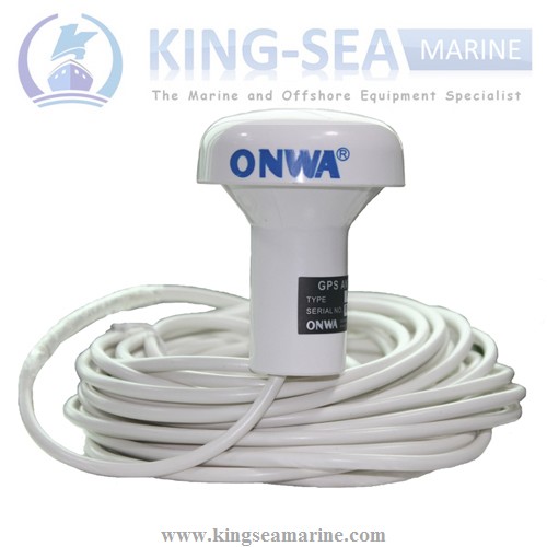
8. Antenna |
KA07 |
|
EQUIPMENT LIST |
|
|
Standard |
1 Display unit 2 Antenna unit with 10m cable 3 Operator manual 4 Installation materials and standard spare parts
|
More details of product, welcome to contact kevin@kingseamarine.com.
Looking forward to your inquiry!